


Local children
The Kokoda Track is a grueling multi-day trek in Papua New Guinea that holds immense historical significance, as it was the epicenter of the Kokoda battle between the Japanese and Australian forces.


The Kokoda Track is a grueling multi-day trek in Papua New Guinea that holds immense historical significance, as it was the epicenter of the Kokoda battle between the Japanese and Australian forces.
Before embarking on my adventure to Papua New Guinea, I’d wondered every detail about what it was going to be like. I was so caught up in the mindset that completing the 96 km trek was going to be the most memorable moment of my trip.
However, I’m very happy to say I was wrong.
Although this was definitely a highlight (and an emotional moment for all of us)… the locals and the villages we visited definitely had a much greater and longer lasting impact on me. Therefore, this is the first of two parts I will be writing.
The first follows our trip leading up to and on the Kokoda Track. This includes the challenges, highlights and everything that comes with walking 9 days through mountainous terrain. Part two will highlight our time in the northern villages and the incredible experiences we were fortunate enough to have. This is a must read!
What is the Kokoda Track?
The Kokoda Track, also widely known as the Kokoda Trail, is a single-file track through the Owen Stanley Range in Papua New Guinea. The track was the where the 1942 World War II battle between the Japanese and Allied forces was fought. The track runs from Owers’ Corner in Central Province, through rugged and isolated terrain which is only passable on foot, to the village of Kokoda in Oro Province. It is 96 kilometers long and reaches a height of 2,200 meters above sea level as it passes around the summit of Mt. Bellamy.
There are several well maintained campsites and villages along the track. When walking the track, you won’t necessarily stay the night at all of them but you will definitely pass through them all. The trek leader/guide chooses the best location to stop, depending on the groups speed and projections for each day. The map below is a cross-section profile of the track. The orange dots are the camps we stayed at as a point of reference…

It all began in Port Moresby
I flew into Port Moresby on the 20th of September where I was met by Adventure Out Guide Terry, who collected me from the airport and showed me to my accommodation. Later the same day, I met the two lovely ladies I’d be walking the track with, a mother-daughter team by the names of Vicki and Kendal. We all shared a chatty nature which instantly told me there was never going to be a dull moment. We all spent two nights at the Ponderosa Family Hotel in Port Moresby prior to starting the trek. This gave us time to get ourselves ready and get acquainted. During this time we also got to know our amazing Papuan Trek Leader Basil, Terry’s wife Salome, and her lovely daughter Joanne.
We used this time to check through the items we were bringing on the track and separate those from items we would later donate to the villages. We packed our bags, had a good look at the map, our route and campsites, all while Terry shared lots of interesting track history and local knowledge with us. On our final night Vicki, Kendal and I completely packed our bags, ready to go for the next morning, repeatedly asking one another “WTF are we doing?”.
Before we knew it, it was time to check out of the hotel… bags, boots and hiking poles ready to go. We drove to the airport to pick up the rest of our Papuan team members (porters) who had just flown over from Kokoda, then started the long drive to our start point, Owers’ Corner.

Bomana War Cemetery
En-route we stopped to visit the Bomana War Cemetery, a Commonwealth War Graves Commission cemetery dating from World War II. The cemetery is the largest war cemetery in the pacific region and contains 3824 commonwealth burials, 699 of these unidentified. At the back of the cemetery stands the Port Moresby Memorial that commemorates almost 750 men (Australian and allied services) who have no known graves, as their remains may have never been recovered. Among these names were members of the Australian Army, (including Papua and New Guinea local forces), the Australian Merchant Navy and the Royal Australian Air Force. It is a peaceful, very well maintained testament to the many personnel who lost their lives in the fight to retain the Pacific.

Owers’ Corner to Goodwater Campsite
After a long and bumpy bus ride later, we came to a stop two kilometers short of Owers’ Corner, due to a very boggy section of road. While waiting for the men to decide what they wanted to do, we took photos with the local kids. Finally, the decision was made to not take the bus any further. This was where our walk started.
We followed the road trying not to slip on the patches of mud, and just as we were coming close to Owers’ Corner the rain came and saturated all of us. Upon arrival, we took shelter and had some lunch while we let the worst of it pass.
When the low-lying clouds disappeared we took our first look at the terrain we were about to enter into. This comprised of a very steep descent to the Goldie River and an intimidating first look at Imita Ridge, the first of seven steep climbs we’d be tackling.
The goal for today was to get to Goodwater campsite, close to Uberi. So after some lunch, we took a group photo under the arches and started down the slippery slope.
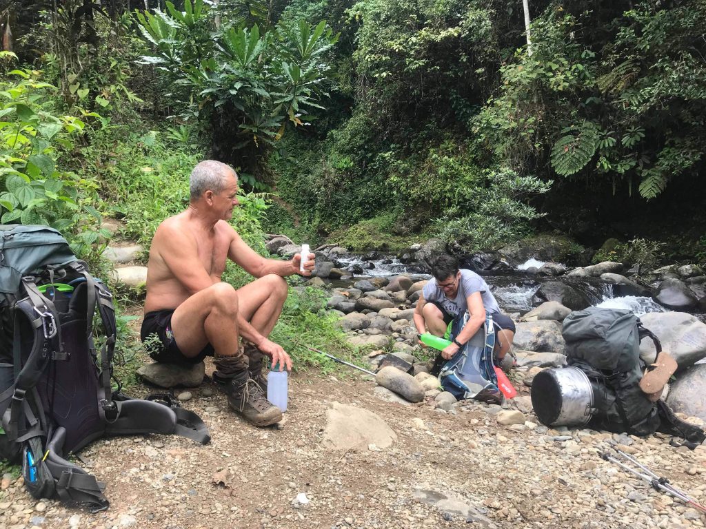
Our small group moved slowly, as we got comfortable using our hiking poles in steep terrain, and at a pace that suit the whole group. In saying this, our porters worked hard to keep us moving downhill because they were nervous about the water level of the Goldie River rising too high that it would prevent us from crossing. Their concerns weren’t misplaced. The river was above waist deep and the flow was strong by the time we reached it. We changed into our sandals as our porters carried all our luggage across, before coming back to help us across.
If our porters weren’t there with us, holding our hands as we crossed, we each would have been swept off our feet! Thankfully they’re all very strong and they helped each of us get across our first of many river crossings safe and sound. From here we started climbing upwards until we arrived at Goodwater campsite.

We were all soaking wet when we arrived so used the afternoon to dry off, rest our feet and drink much needed water. We set up our beds for the night (a mosquito net over an air mattress) and enjoyed a nice warm cup of tea. Our legendary chef, Bowen cooked us a delicious hot meal, the first of many!
I vividly remember on this night as I brushed my teeth, I stared into the darkness outside of our hut and saw fireflies! I watched them dance around in the cool (but still humid) night air. It was an incredible start to the trek! I felt so comfortable. It was so great to be out in nature, away from the noisy city of Port Moresby and to no longer be confined to the fences of the hotel… I couldn’t have been more relaxed.
Goodwater Campsite to Ioribaiwa Village
Terry decided it was best for us to wake up early and get going as soon as possible (a trend that would continue throughout the walk). So we woke early, had breakfast and put on our (still very wet) clothes and hiking boots… nothing really ever dries on the track… And we were ready to walk by 6:30.
This started with a brutal climb up to the summit of Imita ridge. Steep climb one of seven. As I said before, we moved at a pace that suit the whole group so we took lots of small breaks, especially on hills. It was a challenge! This climb finished with what’s known as the Golden Steps a very steep last push to the top. According to Terry it was coincidentally named this and not related to the Goldie River, much to my amusement.
We reached the summit of our first steep climb, and took a well deserved break. After catching our breath, Terry explained that this ridge was where Australia held their last line of defence during WWII.

It was the craziest feeling to think the afternoon before, we were standing at the start of the track looking at the daunting climb, but here we were now already on our way down. However, we also knew there were many more challenges to come.
The steps down were super steep… in fact most of the descent was very steep. After Imita we had a whole lot of downhill, and a whole lot of getting our feet wet again as we crossed through water 22 times!

Somewhere along the way, a leech decided I would be a good host and attached itself to my shin. Needless to say this idea didn’t end very well for him as Vincie got rid of it for me.
By lunch time we had crossed 14 of our 22 creeks, we stopped at a lovely little village. We watched the locals do their thing, we ate, had a cuppa and refilled drink bottles.

The scenery was stunning! We passed so many beautiful little waterfalls, I was stopping at almost every one to take another photo. I had to keep reminding myself that they were not uncommon in this country and that we’d be passing many more.
We were just coming down to another creek crossing after lunch when we heard a very loud noise that sounded almost like a gunshot. We continued down to the creek, and mid creek crossing we heard it again except this time we knew it was a very loud crack from the tree literally right next to us. We hurried forward to make sure we weren’t around when it did fall and warned hikers going the other way.

I remember this funny moment where we did a solid 35 minutes of demanding uphill walking before Vicki was almost begging for a break. She could swear she was dying. Then she laid down and told us she could see a little purple smiley face next to her head. I honestly thought she was seeing things, but it turned out to just be a cool little purple mushroom.
At 4:30pm we walked into Ioribaiwa Village. A very tidy little place with lots of local children. Ioribaiwa Ridge was the most southern point reached by 500 Imperial Japanese Army men during the war. Once again, we had a hot drink, relaxed as best we could and had a shower.
The shower was only a metal pipe coming high out of the ground, and with no option other than cold water, but it was beautiful! It was surrounded by a cylindrical wall of vines and other plants allowing for some privacy, and had a rocky floor. It was very sweet and refreshing on my sore legs.

I felt much better after a shower, so went for a little walk to admire the view because we’d climbed significantly high during the walk. The local kids came out to play for a while as well, we handed them small gifts and made paper airplanes with them.
After a while we retreated to the peace of our hut, we rested, relaxed and attempted to recover, when Desmond called us out to come and see the sunset. It was vibrant with colour and just a peaceful moment to share with beautiful people.

Kendal and I had a great chat with Desmond, one of our porters, before bed. This man has such a kind soul and it was a pleasure to get to know him. Afterwards I slept as best I could and attempted to ignore the noisy roosters that continued throughout the night.
Ioribaiwa Village to Nauro
We woke at 5am again and were walking as early as possible. Little did I know but that was going to be one of the longest days on the track. As we walked out of the village we saw a large branch fall from high up in the trees and landing on the track ahead. As we came closer, we saw that the branch had completely blocked the track so Vincie got in there with his bush knife and chopped parts away so we could pass through.
With no time to warm up, today was straight into our second steep climb made more challenging as we had to navigate our way over tree roots. After an hour of climbing we reached Ioribaiwa Ridge. We spent a lot of time here, spoke to some other trekkers that were going the other way, then went for a small walk without our packs to see remnants of some old ammunition pits from the war, both Japanese and Australian.
The track then followed a ridge line again for a while before it became a very steep (and still slippery) descent. Eventually we reached Ofi Village, which was beautiful, located right on Ofi Creek. We changed to our sandals, crossed over and refilled water bottles.
Then it was back into another brutal climb. The gradient was so steep we were almost straight above Ofi creek in no time. It was ridiculous, and very challenging but the view was great! Originally, the plan today was to get to Brown River, but at the pace we were moving at it wasn’t going to happen, so we had lunch earlier and decided we’d aim for Nauro instead.
From here it was a whole lot of uphill, Terry walked ahead because he wasn’t feeling great and needed to lie down. He put us all in the capable hands of Basil and the team, and asked Basil to work with me until we reached Nauro. We moved slowly, Desmond kept reminding us that it isn’t a race which was really nice. We were supposed to be coming up to a very steep climb known as the ‘Japanese Steps’. We kept thinking we were at them because it was all so steep but the boys repeatedly told us ‘No, not yet. We will tell you when’.
The sun as getting lower and I was worried we were going to end up walking in the dark. After a while of undulating ground, we came to yet another steep climb. The third of our seven most difficult climbs. Desmond said I should go to the front so I sped up to catch up with Basil.
At the top Basil told me we had finally just climbed the steps. Vicki and Kendal were very happy to hear this when they joined us at the top. The boys applauded our efforts, we took a quick break but we had to keep moving. It was another 5 minutes to the top.

At 6:30pm, after more than 12 hours of walking, we dragged our feet into Nauro Village, head torches helping us find our way. I reluctantly had a cold shower. Then we had a quick dinner, a hot cuppa and finally… went to bed. It was a very tiring day.
Nauro to Menari
We woke at 5am again, but took it easy this morning. Instead of just packing up and leaving we took time to administer some self care and first aid. Vicki covered some blisters and I strapped up some chaffing. I was getting sore spots on my shoulders from my pack sitting wrong on my sports bra strap, and on my shin from my gaiters.
We got a good look at the hut we slept in which was beautiful, and Terry showed us that the clothes line was made from an old communication wire from the war, which was pretty awesome. Eventually we started walking again.
There was a fair bit of mist in the air as we started trekking, which meant the sun shining through the trees looked unreal! After a small amount of downhill, we came a section Basil called ‘Morrow Swamp’, and boy was it muddy! There was a very long section of track that was pretty flat, and would have been easy walking if it wasn’t so muddy and slippery.
Then we came to more swamp except long green grass was growing all the way through, and the tree canopy disappeared so we were exposed to the hot sun. We followed low bridges that had been built the whole way through.
We crossed lots of bridges today, some more stable than others but all built in a similar fashion. Most are made from 3 or more tree trunks laid across the water and tied together. Our porters would always tie a rope across so we had something to hold on to as we crossed. They were great at taking care of us.
It was quite hot so it was a great feeling to reach the Brown River where once again we changed into our sandals and the boys carried all our gear across for us. We found a nice shady spot to change back into our boots, then continued with the squishy, muddy walk.

The walk then turned to a very steep uphill once again. This was known as ‘The Wall’. Vicki believed this section was harder than the Japanese Steps. The steep climbing lasted around an hour. The mood had changed, I tried to keep conversation going but we were all focused on just getting up this bloody hill, so it became a very quiet, determined walk.
Out of the blue, right at the back of our small group, Basil started belting out lyrics from “Take Me Home, Country Roads” by John Denver, and everyone joined in. Their voices were so nice I got goosebumps and it really lifted our spirits.
We arrived at Menari at 3pm, which was a big village compared to what we had been staying in. Outside our hut we had a look at some war remnants that had been placed here. There were Japanese helmets, mortars, magazines and grenades.
We looked at this for a while, then it started pouring with rain. We had a shower (it was so nice to shower with an open roof while it is raining) and relaxed for the evening.
Menari to Efogi
We started the day at 4:30am to try cover some extra ground after a bit of a more relaxing walk the day before. We got dressed into our wet clothes once again but this time I cut the shoulder straps off my sports bra, turning it into a boob tube, to try eliminate the pressure point that was causing my shoulders so much pain.
We walked out of Menari as soon as we were ready, Desmond and Vicki both took a fall before we’d even left the village. Our big climb today was up to Brigade Hill, with a few bridge crossings again.
The mood was low so the boys sang for us again. This time they sang a song for us that Terry explained was about a letter from a boy to a girl. I didn’t understand the lyrics but their voices, and how slow and soulful the song was made me want to cry. They were a pleasure to listen to.
It took more than three hours to get to the top, but we had a great lunch waiting for us. Bowen had made us doughnuts! Terry then took us for a look around Brigade Hill and described the battle that was fought there.
After Brigade Hill we came to what I would consider my favourite part of the track. We called it the non-compliant section… but I won’t get into why. This section of the track is so high up in the mountains it allows for amazing views over the surrounding area. The track here is very, very steep. Careful footing and concentration is required! The pictures don’t do it justice (some are taken from video so apologies for quality).

We arrived at a the creek just below Efogi and had a quick stop. We climbed up and into the Village. We were half way through the track! As we were walking in there were villagers coming up behind us.
The ladies were carrying more than my body weight in potatos and firewood in bags that hung on their heads! It was incredible. A little boy, who would have been no more than 3 years old ran along side them with a large knife in his hand. That was normal here.
We stopped in the middle of the Village and Kendal and I bought everyone a soft drink. Since there is no other way into these villages than to walk, someone had walked all these snacks and soft drinks all the way in here just to make a bit more money. The cans said they were only 2k (PNG Kina) each, but they were selling them for 7k… about $3 Australian! 5k more was well worth paying for the physical effort required to sell these! It also tasted amazing.
Post-refreshment we continued onward to the top of Efogi, another final steep climb to the top. We crossed one last creek where carvings from WWII could be seen where men had scratched things like names and battalions into the rocks. Not long after, with hearts racing and breathing heavily we arrived at the top of Efogi. We were half way through! We got in early enough to have a shower and try to get some of our stuff to dry before the afternoon rain came.

At sunset Desmond took Kendal and I for a walk to look back down over the the lower end of Efogi village. He spoke about how great it is that we are doing the track, how great it is that we are helping Terry. He told us he hopes to empower his daughters to stand up to people who tell them they wont be able to do something because they’re a girl.
On this note we thanked him for taking us to see the sunset and sharing with us, and we walked back. I asked him how long it’d take him to do the track alone and he said the fastest he had done it was 3 days!
After some dinner and a nice hot cup of Milo by the fire, we had an early night.
Efogi to 1900
Another 4:30am start after a not-so-great sleep, we got on the track as soon as possible because we had another big day of climbing ahead of us. We were headed to 1900, the highest altitude camp at (as the name suggests) 1900m above sea level.
In my opinion, the first climb up to Naduri (besides my persisting shoulder pain) wasn’t that bad. We reached the village by 9am and took a solid break in the shade and got chatting to some trekkers going the other direction.
We then climbed uphill for maybe another 3 hours where we met up with Chef Bowen and Johnkay, who had prepared lunch for us. This was when the heavens opened and the rain came, heavy and fast. We all crammed under Terry’s umbrella and ate.
At this altitude the rain is cold! With so much rain in a short amount of time the track turned into a river and we did our best to walk on the least slippery ground. It was crazy!

We pushed through. At the top of yet another steep section, Terry stopped us all and he told us that we’d just completed the seventh of the seven steepest climbs of the Kokoda Track! Vicki let out the loudest cheer and we all happily congratulated each other on our achievement. From here it was another tame hour of walking to camp.

We got there but we were all so cold that no one wanted to swim, so we just rinsed our legs in the creek that ran through the camp, then got dry and warm.
We warmed ourselves in the communal hut by the fire, drank tea and ate biscuits. We had a little dog friend that sat with us too. It stopped raining for a little so we went for a small walk but that was short lived.

Things I have noticed along the track so far:
1. There is a lot of rubbish along the track, which is pretty disappointing for somewhere that is one of the most beautiful, untouched places in the world… a country that has a global share carbon footprint of 0.03% .
2. Everyone is extremely strong because the lifestyle is physical labour intensive. They all work bloody hard!
3. The kids carry knives… everyone carries knives… gotta get used to that.
4. The track has been challenging but achievable! We are doing it much more comfortably than the men who fought in the war did. It’s mind blowing to follow their footsteps and experience the terrain first hand. “
1900 to Templeton’s Crossing
I woke up at 1am and needed to wee, I walked outside to find Vicki wandering around in the dark and she said “I can’t find the bloody toilet!” so I turned my light on for her, and left a red light shining out of our hut for when she needed to find her way back. Another funny moment when when we look back on it.

At 5am we were all awake,, and after putting on semi-dry, smokey clothes (they’d been drying in the boys hut all night) we got moving. The track started steep but became pretty gentle as we walked through the “Moss Forest”. It stayed pretty gentle all the way to “The Gap lookout”, the highest point on the track. Apparently there’s a really good view up here of Mount Bellamy but it was too cloudy for us to see anything, so we kept trekking.
We started descending, passed a group of school kids, and took a break when we found an open area. It also had a pretty amazing view. Our aim was to get to Templeton’s Crossing and see whether we wanted to keep walking from there or not.

We reached Templeton’s by 2pm and decided we wanted to continue, but Basil told us it wasn’t a good idea becasue the weather was turning bad, so we stayed. Bowen had already made us lunch and Johnkay had put on a pot of hot water for another round of warming teas.
We got into warm clothes and before the rain came we went to the creek, washed our legs, boots and gaiters. Then we relaxed in our hut, that had a fireplace inside! We looked at some more remnants of the war and then had some delicious dinner and rice pudding before much needed rest.
Templeton’s Crossing to Isurava
Our second last day on the track! We woke at 4:30am again, and had yummy pancakes for breakfast. It was a cold morning, but at 5:50 when we started walking, we warmed up pretty fast! In saying this the weather was ideal walking weather. With a few uphills and downhills we walked for a solid 3 hours before we came to a stop.
Terry then took us down a side track to see an ammunition pit that had been dug up and put on display. There were mortars, hand grenades, huge bullets, magazines and a few other things. It was a whole lot of explosives in one spot! We took a bit of a break, taking in everything that was here, had a bite to eat then continued.

We crossed a lot of small bridges and one large bridge, over Eora Creek. We descended to yet another creek where we had some lunch. Kendal and I used this time to have a lie on a rock and look at the sky and trees above us. It was very peaceful, and it gave us all a little time to recover.
Then once again, after some uphills and downhills, we came to a steep-ish climb into Alola Village, a beautiful village that overlooks a beautiful valley. Vicki was pretty dead by the time we reached the museum so we took a well deserved break and possibly got the greatest photo of the trip!
Before leaving we had a quick look in the museum at all the different guns and ammunition that had been collected from the area. Then we kept moving, first up before a very steep descent. By now we were all feeling the fatigue hit, even some of the porters were pretty sore.
We walked down, and down, and down…. Basil got us to take another quick break at another spot with a great view before another 45 minutes of downhill. Then a little bit of uphill before we reached Isurava Village.
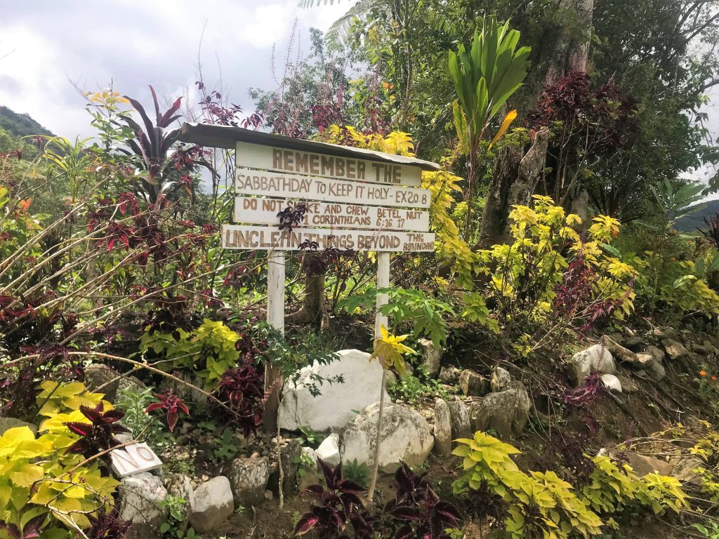
I wasn’t the biggest fan of this hut. It had spit stains everywhere inside from the betel nut that a lot of the locals chew and holes in the floor boards, but it was a place to sleep. I took off the strapping on my shin for the first time since I’d covered the chaffing and was disgusted to see that it had festered into gross blood blister, puss spots all around my shin. I washed and let it air that night.
Isurava to Kokoda – OUR FINAL DAY!
Day nine – the finish line. I woke and re-strapped my shin. We had breakfast and packed up. Before we left we made sure to go down to the memorial site and see the pillars. Four sentinel stones that read ‘Mateship’, ‘Courage’, ‘Strength’ and ‘Endurance’ representing the resolute commitment and sacrifice of the Australian soldiers.
We had a read of the information about the site, the battle and the ‘Fuzzy Wuzzy Angels’, the Papuan helpers in the war. The Fuzzy Wuzzy’s would carry supplies forward and wounded or injured Australian soldiers to safety throughout the war.
We walked through Isurava Village where we bought some bananas and snacks. Being the end of the track, most of it was downhill or following a ridge line. We passed a lot of groups heading the other way and tried to be humble, we were in their position not too long ago, just starting out.
Around 1:30pm we reached Deneki where we had some pizza and chips that Bowen had made us for lunch. We could see Kokoda from here and it honestly still looked so far away, but we were going to finish today. After coming down from Deneki, the track was mostly flat.

We walked on until we reached Hoi, had another quick break and then lastly through another small village. It was as flat as ever now, which sped up our pace.
When we finally saw the arches at the end it was an awesome feeling! We all walked next to each other for the final hundred meters. Locals were applauding us and saying well done as we got closer which was very sweet. Vicki got emotional which made me emotional.

At 5pm on the 30th of September, after nine long days… Vicki, Kendal and I passed under the arches together, ending our Kokoda Trek. Congratulations were in order, we said thank you to all our boys and there were hugs all around. We met our lovely driver Murray who took us straight to the bottle shop to pick up some celebratory beers and then to Johnkay’s village in Kokoda. This marked the end of our trek, and the beginning of the village stays.


4 Comments. Leave new
Amazing job GF. We will never forget this journey xx
Brilliant lady, I really enjoyed reading Part 1 of your adventure, you really took me there. I look forward to Part 2.
Cheers
Phil McGuiness
This girl is so good. It takes a lot of sacrifice to do something like this. Well done ,what an achievement to your young life. Keep up the good work on your writing , so interesting.
Amazing read, brought back all the memories of my time on the track in 08, I vividly remember every step.
Tim